
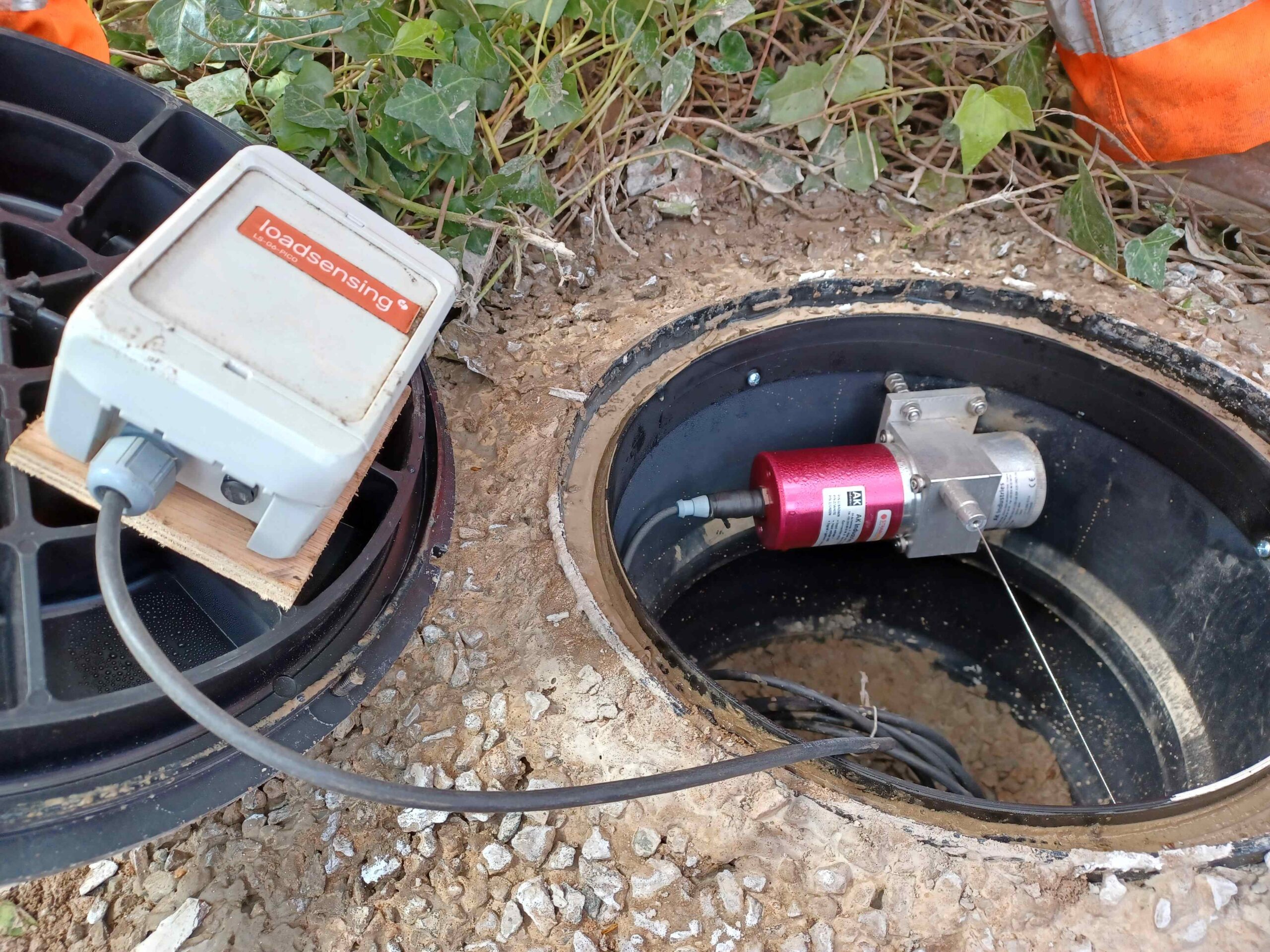
| An array of specialist hi-tech equipment that will monitor any ongoing movement in and around Leeson Road in Ventnor has now been installed.
Island Roads staff have been working with site investigation experts SOCOTEC to install monitoring equipment that will measure and record lateral and rotational ground movement. The data gathered will help Island Roads and the Isle of Wight Council make informed decisions about the future of Leeson Road. The array comprises three extensometers to measure and record changes to visible cracking and 22 tiltmeters recording rotational ground movement. This will shortly be complemented with three global navigation satellite sensors providing remote monitoring of vertical and horizontal land movement. Stephen Ashman, Island Roads service director, said: “It is vital that any future decisions made about Leeson Road are based on the most accurate data and understanding of the ground conditions at this location. “The various equipment installed last week will help us in that process.” The upper section of Leeson Road has remained closed since a catastrophic landslip in December 2023 when 16 hectares — some 14 million cubic metres of land — was displaced in what was one of the largest landslides recorded on the South Coast of England. The council will be addressing the current situation at Leeson Road as well as other access issues currently affecting the town, at a further public meeting in the town next month. More details will be announced shortly. Natasha Dix, the council’s service director for waste, environment and planning, said: “All the advice from our consultants is that more information is needed before we can properly asses the risks around re-opening the road. “It is also important to remember that the risk of further collapse is down to the wider geological movement in the area — not necessarily the weight of any traffic using it. Visually the road surface may look perfectly fine but what we don’t currently know is what’s happening deeper underground. “This highly-sophisticated equipment will help us to peal back the layers to see the geological conditions underneath the road and whether there is voiding or further ground movement that could lead to a further catastrophic collapse.” The Leeson Road webpage, which includes answers to frequently asked questions, is available via www.islandroads.com and Leeson Road Ventnor landslip (iow.gov.uk). |
Monitoring equipment now in place at Leeson Road
Share this page